
Yuba River
Overview
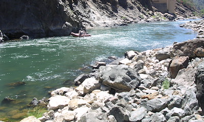
In 2003 the USFWS invited Prof. Pasternack and his group to conduct SHIRA planning and pre-project phase investigations on the lower Yuba River, which begins below Englebright Dam. From 2003-2007 this work involved a paired study of the extremely degraded bedrock canyon immediate below Englebright Dam (left photo below) and a reference outstanding site in Timbuctoo Bend (right photo below). This research yielded many scientific results documented in the report by Pasternack (2008). It also guided several management developments, including both beneficial actions taken and costly, unhelpful actions avoided. Instead of leading to spawning riffle enhancement project similar to those done on the Mokelumne, Trinity, and Feather Rivers, this SHIRA project ended up recommending a gravel/cobble augmentation program. That program was piloted in 2007 and then got underway in earnest in 2010. It continues to this day.

Scaling Up From Sites To Whole River Segments
After the initial SHIRA project ended in December 2007, Prof. Pasternack and his group got involved in comprehensive scientific investigations, management activities, and river rehabilitation visioning on the LYR by collaborating with the lower Yuba River Management Team. This effort moved far beyond site-based SHIRA and to wholesale efforts to understand and rehabilitate 37 km of river. A website dedicated to the scientific understanding of the lower Yuba River is provided at the link below.
Lower Yuba River Dedicated Website
Documents
- Pasternack, G. B. 2008. SHIRA-Based River analysis and field-based manipulative sediment transport experiments to balance habitat and geomorphic goals on the lower Yuba River. Cooperative Ecosystems Studies Unit (CESU) 81332 6 J002 Final Report, University of California at Davis, Davis, CA, 569pp.