TR Site Description
Trinity River Catchment
The Trinity River above Lewiston Dam is an 1860-km2 basin that is part of the Klamath Mountain Province in northwestern California. It has a high point of over 2700 m, and the terrain is steep with deep gorges. The basin is far enough inland to have extreme weather variations, with winter snows and hot, dry summers. Average annual precipitation ranges from 90-190 cm. Natural streamflow is governed by large winter storms (October to March) and moderate spring snowmelt.
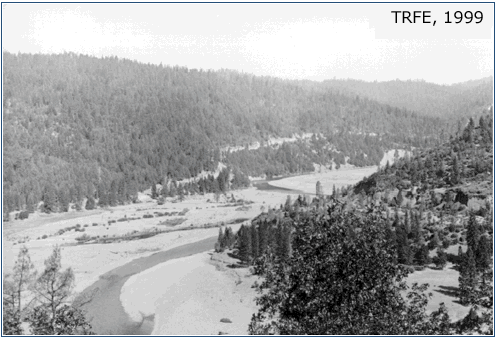
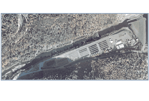
Trinity Dam was built in 1962, with Lewiston Dam built shortly after 13 km downstream. Historically, the river in the vicinity of Lewiston Dam was characterized by a wide channel with inset active alluvial gravel bars and a wide forested floodplain, but now it is narrow and straight. Peak flows at the Lewiston Dam site reached as high as 2100 m3/s prior to damming. From 1962-1979, up to 90% of the total inflow was diverted to the Sacramento River basin. From 1979-2004, diversions were reduced to 75%. Recent legislation has now restricted total diversions to 53%.
Damming of the Trinity River altered channel morphology in several ways. The reduction in coarse sediment has lead to monotypic morphologies characterized by glides with high velocities (USFWS, 1999). The reduction in both the frequency and magnitude of floods has allowed riparian vegetation to encroach channel margins, creating riparian berms and fossilizing gravel bars. This confinement increases bed shear stress through the channel centerline with increasing discharge. Over time, this has led most reaches to develop a symmetric, trapezoidal cross section. Loss of asymmetry has decreased habitat diversity, such that shallow water habitat occurs only on channel margins and is eliminated at intermediate discharges between 11-57 m3/s (USFWS, 1999).
In comparing 1939 versus 2004 images and maps, channel width decreased by as much as 40%. The river is confined on its south (river left) flank by a fish hatchery constructed to offset upstream habitat losses, while its north (river right) flank is confined by bedrock valley walls. Together, these two forcings caused uniform high flow widths that do not promote differential rates of sediment entrainment among morphological units at the 1-10 channel-width scale (Pasternack, 2011).
Pre Dam
|
Post Dam
|
Trinity River Fisheries
The Trinity River supports 18 fish species, including eight anadromous ones. Damming reduced physical habitats by ~80-90% as a result of barring access to ~160 km of upstream spawning grounds and by reducing instream flows necessary to flush tributary-delivered sand, drive geomorphic processes that maintain alluvial spawning grounds, and disrupt vegetation encroachment that degrades rearing habitat (USFWS, 1999). Chinook and coho salmon populations as well as that for steelhead trout have dropped 67, 96, and 53% of pre-dam averages, respectively. Historically, an average of 66,000 chinook, 10,000 steelhead, and 5,000 coho adults migrated past Lewiston each year. Consequently, these species are the focus of habitat rehabilitation efforts, though geomorphic efforts are guided by multi-scalar goals that address systemic factors (e.g., Gaeuman, 2008). Since 1972, numerous projects below Lewiston Dam have been completed, including gravel augmentation, channel reconfiguration, bank vegetation removal, and flow re-regulation (USFWS, 1999; Kondolf and Minear, 2004; Gaeuman, 2011).
Spawning between the three species was distributed with channel gradient, with coho and steelhead spawning in upper headwaters and chinook spawning in the mainstem and tributaries. Superposition of redds is now more common as all three species reach the Lewiston dam with little available space for spawning. The target for a fall-run chinook salmon population is 62,000 (nonhatchery fish). Most spawning occurs in a 3.3-km reach below the Lewiston Dam (USFWS, 2002). Fisheries populations are enhanced by hatchery fish that supplement post-dam in-river escapement of fall-run chinook, spring-run chinook, coho, and fall-run steelhead by 56, 68, 97, and 30% respectively. River rehabilitation activities on the Trinity River include gravel augmentation, channel reconfiguration, bank vegetation removal, and flow reregulation below Lewiston Dam (USFWS, 1999).
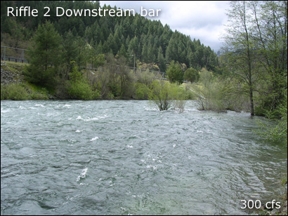
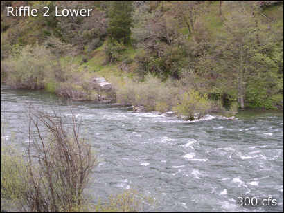
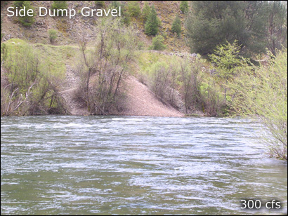
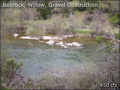
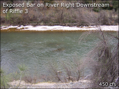
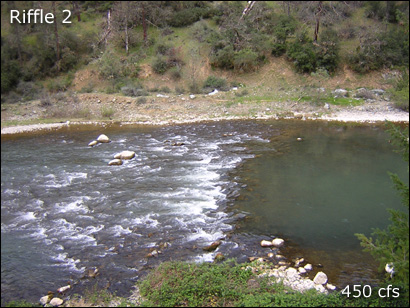
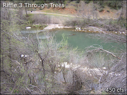
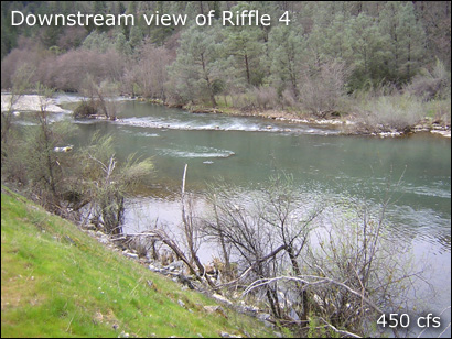
Study Reach
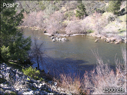
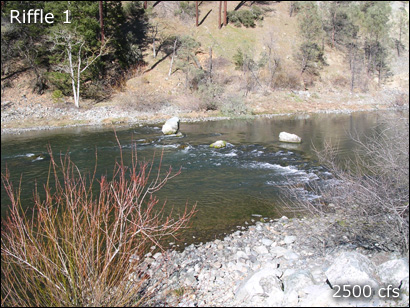
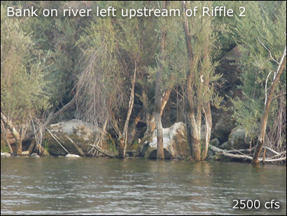
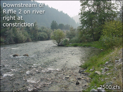
The 760-m Lewiston hatchery reach (LHR) that was the testbed for this study is located immediately downstream of Lewiston Dam and is the uppermost limit of salmonid spawning access on the Trinity River. Previous work in the LHR suggested that the existing topography is controlled by anthropogenic and natural boundary and input controls (Brown and Pasternack, 2008) that limit natural geomorphic processes associated with bar and pool topography despite a rescaled flow regime. Since 1972, there have been numerous gravel enhancement projects below Lewiston Dam resulting in the addition of over 27,370 m3 of gravel and large boulders (Kondolf and Minear, 2004).
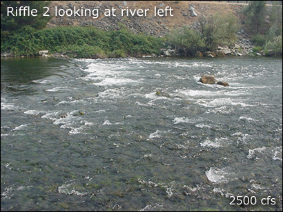
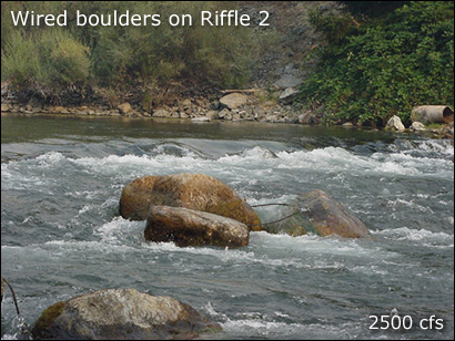
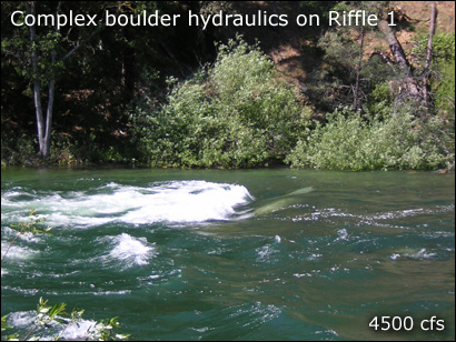
The riverbed is armored by long-term flow and sediment-supply regulation and it has a sequence of coarse artificial riffle-steps (i.e. rock weirs) that are buttressed by boulders and cannot self-adjust under the current flow regime. These structures do not have any of the geometric, hydraulic, or sedimentary attributes of riffles utilized by salmonids for spawning. In addition to boundary controls, reductions in sediment supply from the construction of the dam have led to coarsening of the bed, which further degrades the topography for fish habitat. Together, these controls illustrate that (1) channel rehabilitation in the reach is dependent on physical manipulation and (2) physical manipulation is limited by non-deformable boundary controls (Brown and Pasternack, 2008).
Key study reach questions to answer about the reach before starting:
- Is this a location that ought to have spawn ing habitat? YES
- Is hydraulic head available to provide desired velocities at spawning flow releases? YES
- Can natural processes be restored to this reach? MAYBE
River Rehabilitation Problem Identification
River managers from the Trinity River Restoration Program presented us with two essential questions to answer:
- "The reach immediately below Lewiston Dam is a heavily used chinook and steelhead spawn ing area, but the habitat quantity and quality is too low for the population of adult spawners. Can it be increased?"
- "Gravel augmentation to re -establish the coarse sediment regime is planned below Lewiston Dam, but the locations and methods of gravel placement need further study. How should gravel be placed?"
Trinity SHIRA Project Goals
- Characterize the existing fluvial geomorphology, in-stream hydrodynamics, and spawning habitat at a pi lot test site near Lewiston Dam.
- Develop a recommended construction grading plan for gravel addition that incorporates agency and stakeholder concerns.
- Predict and evaluate physical habitat and associated redd locations for existing and post -construction channel conditions.
- Recommend adaptive management strategies for future grave l addition projects.
Constraints for Trinity SHIRA
Gravel quantity (gravel source?)
"Design the amount that is needed to achieve the rehabilitation goals for the reach" -AK, TRRP
Budget
$48,000 for SHIRA phases 1-4.
Construction access
Easy access to river right bank through public land.
Construction timing
Typically July through mid September.
Potential negative project impacts
None.